Via Transilvanica Hiking trail
See tours
Estern Europe tours
Iconic destinations and authentic experiences across Eastern Europe
Tours from Sibiu
Guided tours from Sibiu to top regional highlights
Create your own trip
Design your personalized journey, your pace, your style
The Via Transilvanica hiking trail is a relatively new long-distance hiking trail in Romania. It is designed to traverse the historical region of Transylvania and showcases the natural beauty, cultural heritage, and historical landmarks of the area. Here are some key points about the Via Transilvanica.
What is via Transilvanica ?
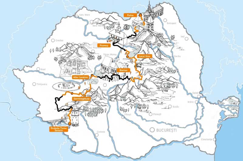
The Via Transilvanica is a long-distance hiking trail that spans approximately 1,400 kilometers (about 800 miles) across Transylvania. It starts in the Apuseni Mountains in western Romania and goes through various landscapes, including forests, meadows, and historic villages, before reaching the eastern part of the country.
The trail was created to promote outdoor tourism and encourage people to explore the natural and cultural treasures of Transylvania. It provides an opportunity for hikers to experience the region’s diverse landscapes and immerse themselves in its rich history and traditions.
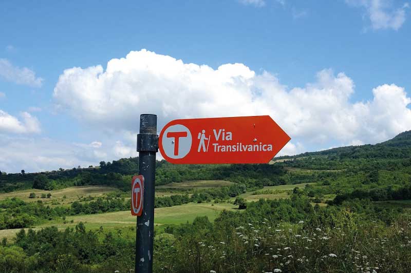
Along the Via Transilvanica, hikers can encounter a wide range of cultural and natural attractions. This may include visits to medieval fortresses, churches, monasteries, and traditional villages, as well as experiencing local cuisine and hospitality. Efforts have been made to mark the trail with signs and provide essential infrastructure, such as shelters and information boards, to assist hikers in navigating the route and learning about the places they pass through.
Transylvania is known for its stunning landscapes, including the Carpathian Mountains, rolling hills, and lush valleys. Hikers on the Via Transilvanica can expect to encounter breathtaking scenery and wildlife along the way. While the trail offers incredible hiking opportunities, it can be physically demanding due to its length and the varying terrain. Hikers should be prepared with proper gear, maps, and provisions.
The via Transilvanica will take you through Transilvania, crossing at least 8 regions: Bucovina, Bistrita, Mures, Cluj, Alba Iulia, Hunedoara, Banat, Turnu Severin.
Bucovina and bistrita
The Via Transilvanica starts in Bucovina, in Putna, more precisely at the Putna Monastery, where Voivode Ștefan cel Mare rests, a monastery founded by him. In the northern part of the country, Bucovina serves as a bridge connecting Transylvania and Moldova.
The 136-kilometer route reveals picturesque areas and historical monuments unique in the world. From in front of Putna Monastery, our journey takes us towards the Sucevița depression, passing through Vatra Moldoviței, through the Obcinele Bucovinei towards Mestecăniș Pass in the Pojorâta commune, then slowly continuing towards Țara Dornelor embraced by the Giumalău, Suhard, and Călimani Mountains. From there, the road winds through hills and meadows until reaching Poiana Negri with its wonderful springs, stopping at Poiana Stampei, a locality that marks the end of the route in the historic region of Bucovina.
Bucovina is a challenge. It is a test for hikers, but also a kind of blessing, because once they have crossed its hills, they are prepared to complete a long-distance trail.
Highlands around Cluj and Alba Iulia
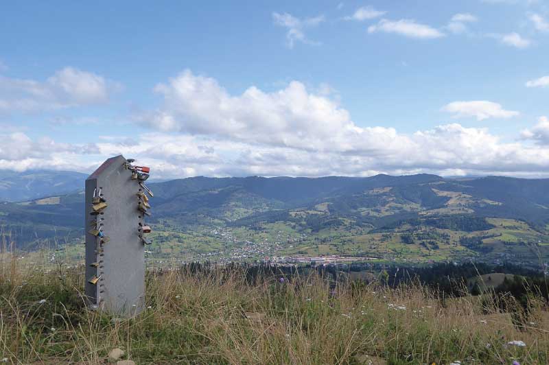
Upon departing from Poiana Stampei, you bid farewell to the Bucovina region and venture into Lunca Ilvei, situated within Bistrița-Năsăud county, nestled at the base of the Rodnei Mountains. This marks the commencement of the 277-kilometer Highlands region. As you journey along the Via Transilvanica, it traverses these mountains, revealing how the ruggedness of the terrain has compelled people to adapt to both nature and changing times.
During this leg of the trail, you’ll traverse a diverse landscape that transitions from mountainous terrain to lowland forests, from rolling hills to expansive fields. It offers an opportunity to uncover the natural splendor and notable landmarks while also showcasing the rich culture that has evolved over centuries, enriched by significant ethnic diversity, imbuing the region with a unique and captivating ambiance.
Around Targu Mures
Terra Siculorum, the Latin appellation for Szeklerland, is a region within our country that plays a significant role in the ethnic, cultural, and historical fabric of the Via Transilvanica. The trail through Szeklerland commences at Câmpu Cetății, traverses the Sovata-Praid depression, and then meanders through the Transylvanian hills, leading to various Szekler villages inhabited by resilient and hardworking individuals who diligently preserve ancient traditions and customs. The journey continues from Odorheiu Secuiesc, often referred to as the “homeland of the Szeklers” (a Hungarian-origin community settled in this part of Transylvania), and proceeds to Archita, situated at the boundary of Harghita and Mureș counties.
This particular section of the trail stands out due to the distinctive Hungarian communities it passes through, each with its unique characteristics. Moreover, the natural landscape is diverse, featuring rounded hills, blooming meadows, dense forests, and pastures. The stages of this route may vary in difficulty and occasionally in landscape, but certainly, as you progress from one day to the next, Szeklerland will reveal its places, people, and ambiance for you to explore. And, of course, let’s not forget about the delicious local cuisine you’ll have the opportunity to savor along the way.
Around the cities of Alba Iulia, Cluj and Hunedoara
The Via Transilvanica route that traverses then the Alba and Hunedoara counties. These counties are steeped in the ancient and recent history of our country, bearing the weight of cities with significant importance. These cities, with their royal, medieval, or ancient Dacian fortresses, sprawl languidly along the route. The Via Transilvanica extends along the Mureș valley and the Târnavelor plateau, adorned with vineyards, before extending its welcome to the Apuseni Mountains and winding its way toward the Retezat Mountains. As it progresses, it increasingly delves into the roots of the Romanian people until it reaches the Iron Gate of Transylvania, within Caraș-Severin County.
This region offers a harmonious blend of awe-inspiring natural landscapes, historic towns, and archaeological treasures. It presents a trail of moderate difficulty, one that leaves an enduring impression on the hiker’s mind and soul, ensuring the experience lingers long after the journey is complete.
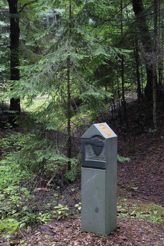
The end of the hiking trail
The final 135 kilometers of the Via Transilvanica lie in the latter part of Caraș-Severin County, commencing from Crușovăț, and the remainder stretches through Mehedinți County, which we refer to as Terra Romana. This region boasts a climatic uniqueness within Romania, giving rise to a breathtaking natural landscape. The history of this land, spanning thousands of years, bestows upon it a treasure trove awaiting exploration. From ancient tales of the Dacians and Romans to concealed treasures in caves and underground, to the paths once trodden by the kings of Romania, and even more recent narratives involving the people who inhabit this area – all can be unearthed by those who open their hearts and minds. The Mehedinți Plateau offers a vista worthy of serving as the majestic culmination of the Via Transilvanica.
It’s a region steeped in local legends and stories known to the inhabitants, making it perhaps the most cherished gem that hikers can encounter along this segment of the trail. The trail’s conclusion in Drobeta Turnu-Severin reaffirms the idea that certain places and narratives can only be truly discovered when explored on foot across the country!
Discover hiking in Romania and come with us in the Bucegi Mountains ! Click here.
Learn more on Via Transilvanica on the official website.
See tours
Estern Europe tours
Iconic destinations and authentic experiences across Eastern Europe
Tours from Sibiu
Guided tours from Sibiu to top regional highlights
Create your own trip
Design your personalized journey, your pace, your style

